Welcome back for part 2.
Here is our cheap tent. Melinda picked it up at a grocery store in Maseru for M350 or roughly $21.82. The tent was about 5 inches shorter in length than I am tall. We barely managed to fit both bags, two sleeping pads, and ourselves into the hovel.
The tent claimed to be waterproof, which was probably true because it had the breathability of a thick garbage bag. That little strip of fabric on top is the rainfly that modestly covers the two tiny vents. My innards fittingly decided to act up that night and I think I farted approximately 300 times (Melinda is a good sport). There was so much condensation build up in the morning that my down bag was soaked. I slept maybe 1 hour collectively so I was a bit mentally fatigued.
I emerged from the cramped and moist cave first and took the liberty of airing out most of our clothing.
It was roughly 40˚ and windy in the morning. I heard “do I have to come out?”. I made us coffee (Hero of the morning) and we bummed for a bit together before it warmed up.
Getting ready for the day.
Getting ready for the day.
There's my girl, ready to tackle another day.
We both layered up for the descent. It was sprinkling off and on all morning.
We headed down the hill towards the same river bed I took the GPS reading at the day prior. We decided to head up the draw, which runs from the bottom right to the top left of the photo.
I was caught with my pants down. We filed up our water containers at the river and headed up the hill.
There were numerous bogs we had to cross. We had to jump from mound to mound in order to stay dry. It seemed like a level from Super Mario World.
Our feet got wet the day before so we took our time to stay dry this day.
Almost to the top. The clouds severely restricted our visibility. At the top we could see the A31 road and a clear route, which would easily take us to Sani Pass. We decided to take the more "interesting" route back. We wouldn’t have seen the Drakensberg cliffs if we had taken the designated route back.
We descended into a valley and the temperature climbed. This shepherd ran over to us to ask "Le ea kae?" or "where are you all going?". They were very curious about us. The shepherds make some interesting clothing decisions. Underwear, a blanket, gum boots, and a beanie seems to be the norm.
We hiked past many shepherd dwellings.
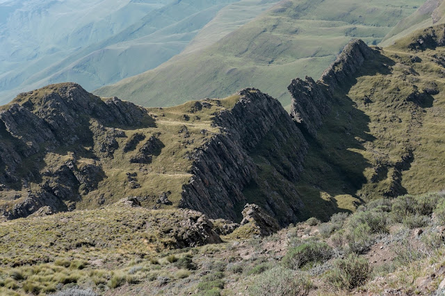
We followed the river south to the edge of the Drakensberg cliffs. I later learned this stretch is known as the Managing Pass.
Looking north from the cliffs. The trail head is just west (left) of the tall flat top peak in the center right of the photo.
We ate lunch and admired the Drakensbergs for a bit. For the most part, the cliffs mark the boundary between Lesotho and South Africa. I did my first international trundle.
Me near the windy cliff.
The Drakensbergs offer some amazing cliff views. The cliffs are the only thing keeping the baboons from getting to us.
A view of the South African low lands. Jeff, Ben, and Wagner planned on walking down the road the following day in order to hopefully see some baboons.
We headed up the Tsatsa-la-Mangaung range to cross into the Thaba Tseka district on our way to Sani Pass.
After I gave Melinda a few “just over this hill's” and “we should be able to see Sani around this next corner's”, they finally rang true. Seeing Sani was a huge moral boost as we were a few hours behind schedule because we decided to take the more adventuresome route instead of sticking to the “trail”. The Masobasoba or Hodson’s Peaks are visible in the background.
We slowly descended the above peak and continued onto Sani.
This ram had painted horns. Melinda said he looked like he was ready to go to a football game.
This sad looking horse was both thin and had a bad sore on his back. I’m guessing it was from bareback riding, which is common in poorer areas. As a side note I thought this photo looked like an M.C. Escher sketch as the hill slopes one way and the horse is leaning the opposite direction.
Almost done. We got to the Sani restaurant around 3pm and met up with Ryan and Lisa Ried, Jeff, Ben and Wagner.
What a trip. We stayed for a few beers with the others and then headed to the road to hitch hike back.
Melinda at the Sani Pass border.
We were picked up by the first vehicle that came our way. It was a nice couple, she was from Mokhotlong and he was from Johannesburg.
The couple dropped us off at the A1 junction and we only had to wait a few minutes for a taxi ride. There were some obnoxious drunk men in the taxi but we both just wanted to get back. Melinda cracked open the window and I was able to capture this double rainbow on the way to my place.
We arrived at my place in time for a decent sunset. We spent the following day unpacking, cleaning, and just relaxing.
Melinda left the following day. We will see each other again on April 29th at the historic Thaba Bosiu site for peer support network training.
Thanks for coming along with us.
Peace,
- Joel


No comments:
Post a Comment